…
© Gudjon T. Erlendsson
Gudjon T. Erlendsson
Löngusker urban proposal
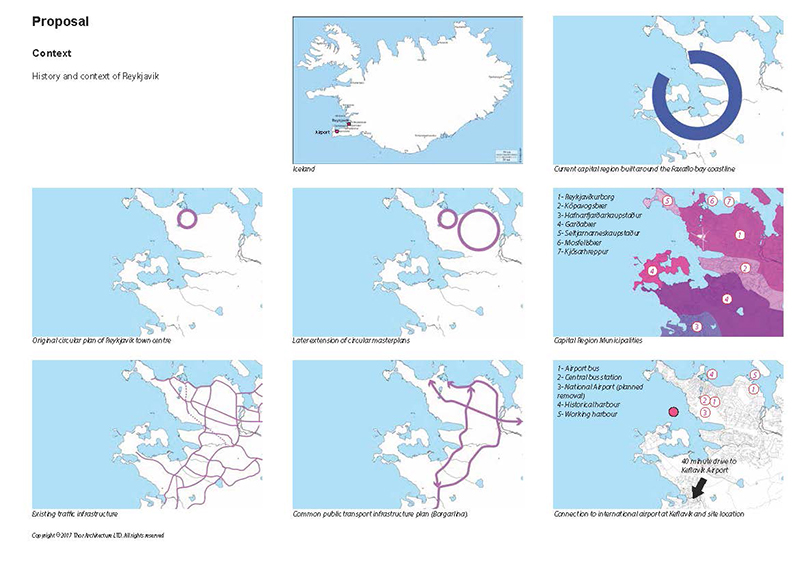
The Capital Region of Reykjavik has developed along the Faxafloa coast line from the small settlement of Reykjavik. The coastline is rugged creating pockets of neighbourhoods on the peninsulas. The rugged coastline has also forced a linear transport system that is proving increasingly costly.
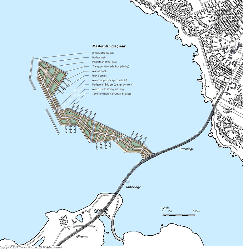
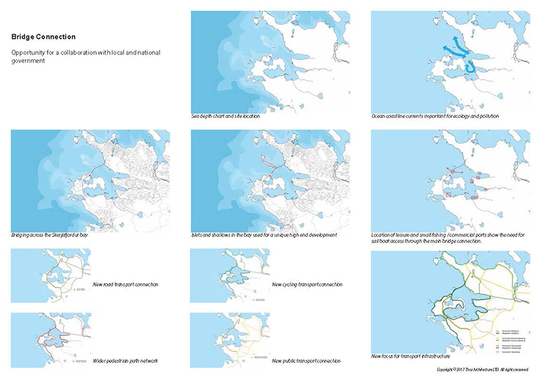
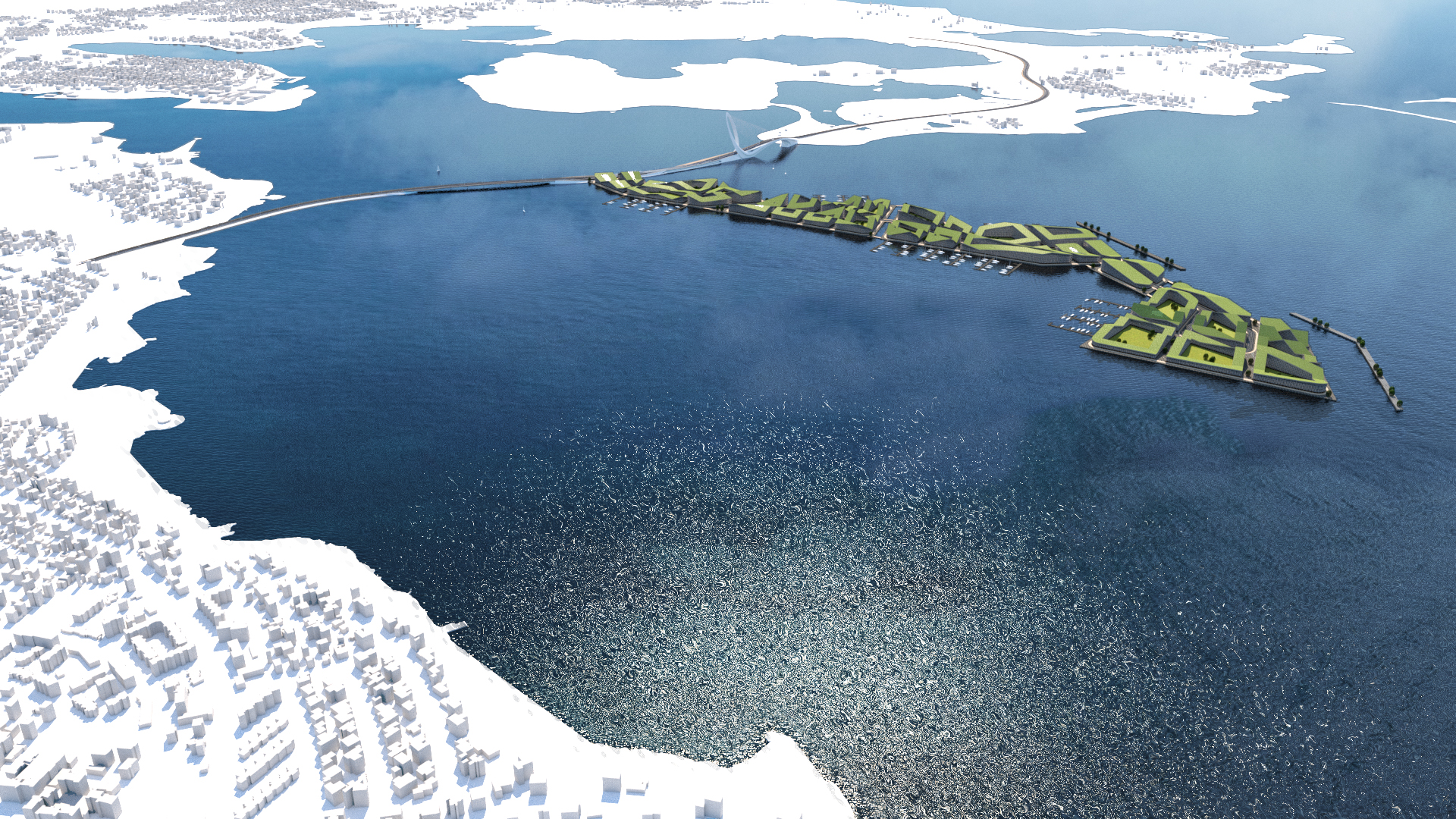
At the centre of the conurbation area lies Skerjafjordur bay, with a number of shallows and small islands at it´s entrance. The development team has identified the islets as a key opportunity for a unique international development.
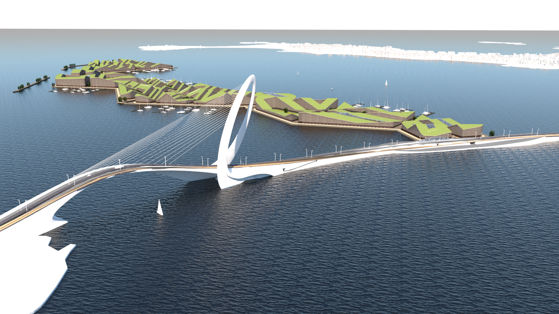
The core development aim will necessitate a bridge connection to the mainland. This connection will carry a mutua benefit with the city of Reykjavik solving offering a major new transport connection to the town centre and turning the city transport from an unsustainable linear system to a circular planning strategy.
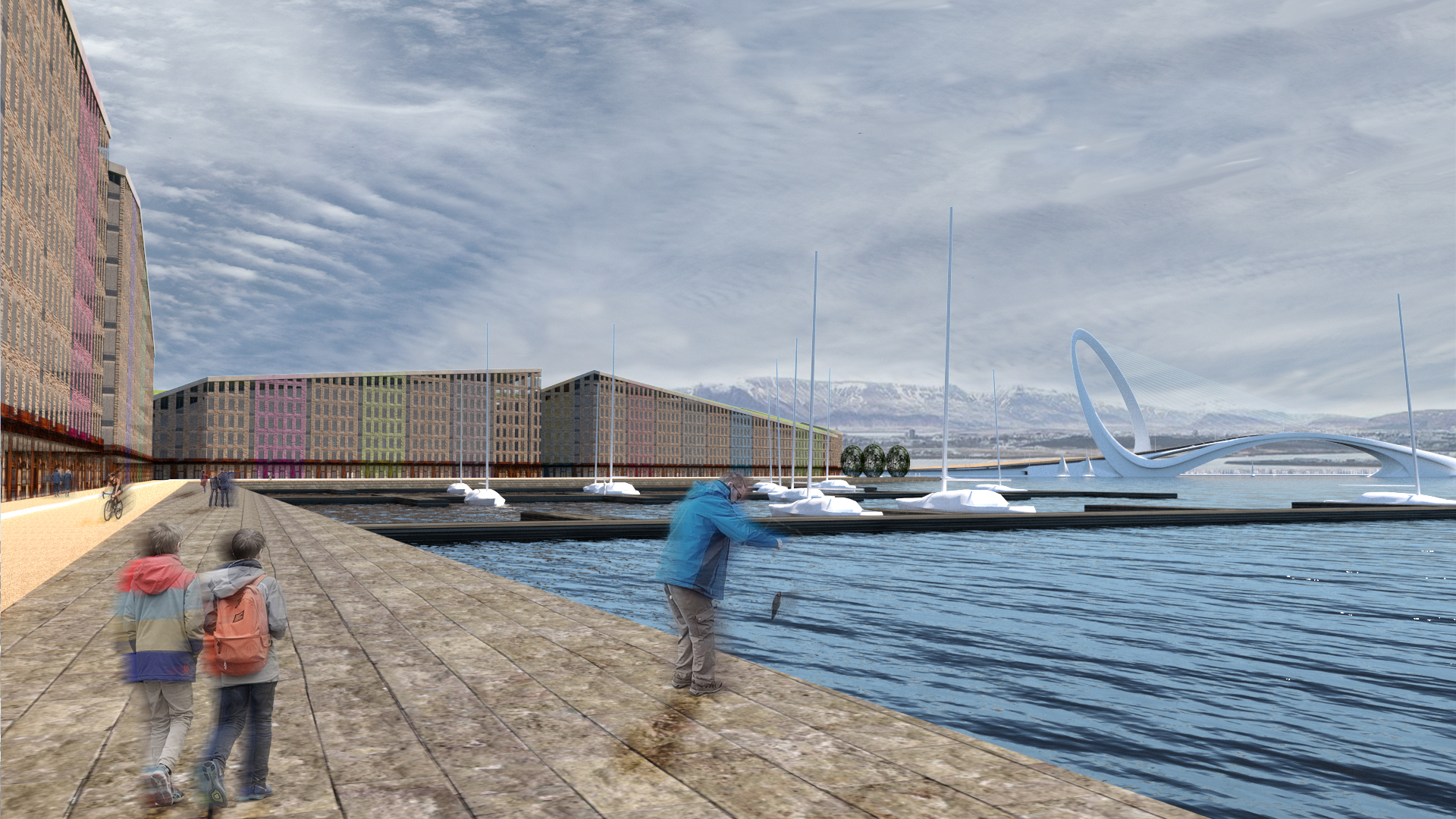
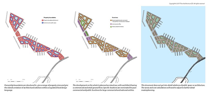
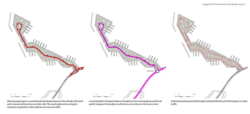
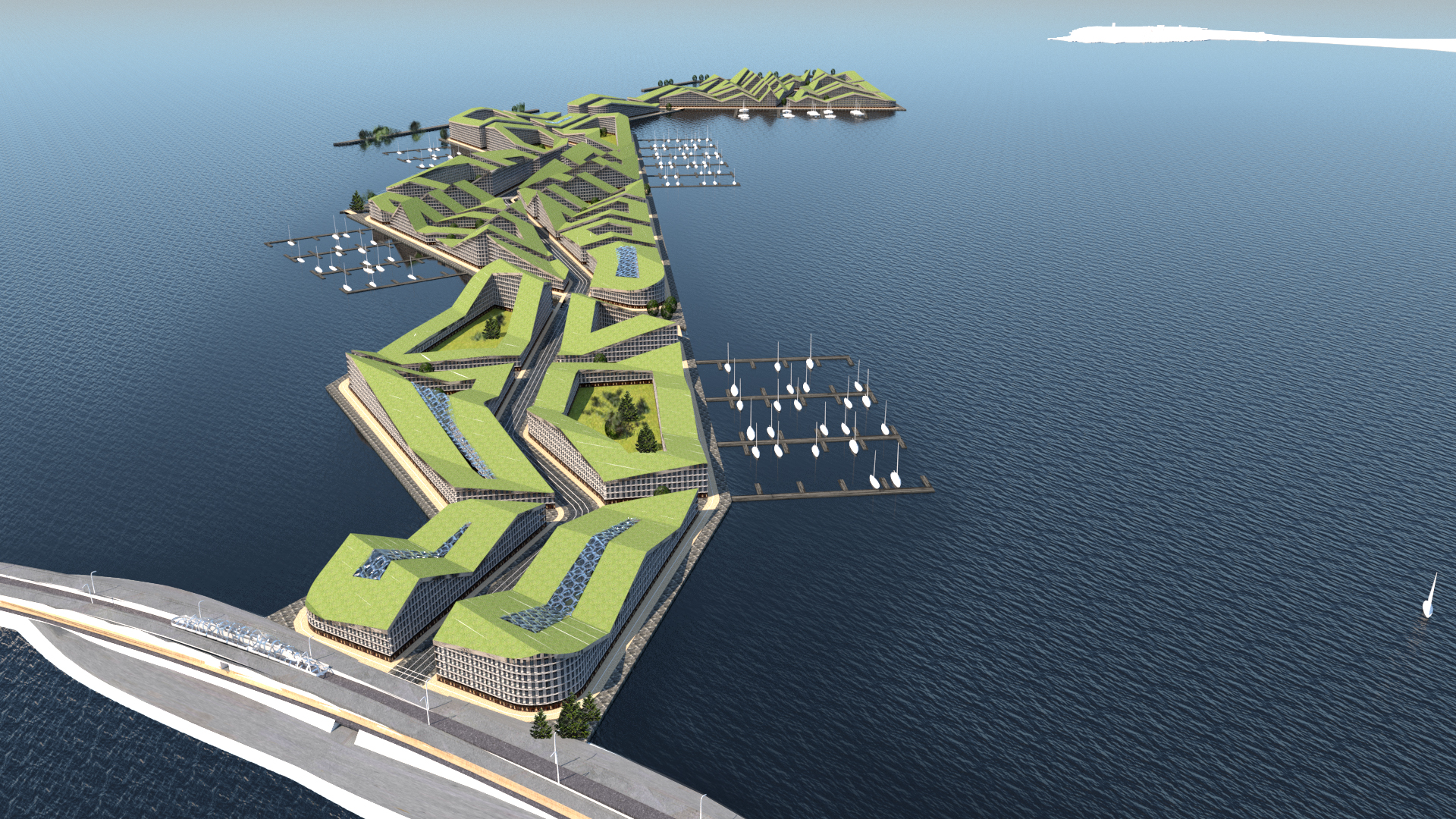
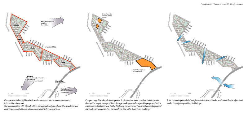
The Longusker development is a 53 hectare proposal for a new neighbourhood built on 5 artificial islands located on shallow shoals in the Skerjafjordur bay. The “Venice” of the north development proposal assumes about 5,000 dwellings and app. 300K m2 commercial space built on a series of small islands with marinas and mixed settlements. A single avenue connected the 5 islands with pedestrian network integrating the neighbourhood into one whole. Piers and marinas circulated the island and access was provided by a road connection to both the city centre of Reykjavik and the Alftanes peninsula.
The customer profile includes international and national investors for a exclusive high end development in one of the most unique landscapes in the world.
Design approach
The vision for Löngusker is in large part governed by the context and opportunities on site.
The land reclamation for both the development area and the bridging highway are driven by the under water landscape with shallow water at the narrowest distance used for the highway and bridges.
The Löngusker shallows direct a long and narrow land form growing north-west from the centre of the highway.
Various masterplan strategies are developed on the base site domain, but the detail masterplan or architectural strategy has not been investigated.
Infrastructure follows the linear structure with the highway point of the development being an important connection node to the city.
Sustainable strategy should be an important design element, with landscape blended with and integrated into the building masses.
The architecture of the new neighbourhood needs to be unique and recognisably local. All to give this location a sense of place.
The development blends together island and canal archetype with sailing docks. A dense European city in the individual landscape of Iceland.
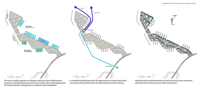
The new bridge connection will form a new major traffic artery into the town centre of Reykjavik. It will also open up opportunities for sensible development in Alftanes peninsula to the South.